
QuantaRoute Maps: an India-first basemap built on OpenStreetMap
A basemap for developers and businesses in India: vector tiles, three ready-made MapLibre styles, and India's outer boundary drawn as the Survey of India draws it.
Nothing to sign up for to look around. Map data © OpenStreetMap contributors.
What you get
A basemap that is open about where its data comes from and what it can and cannot do.
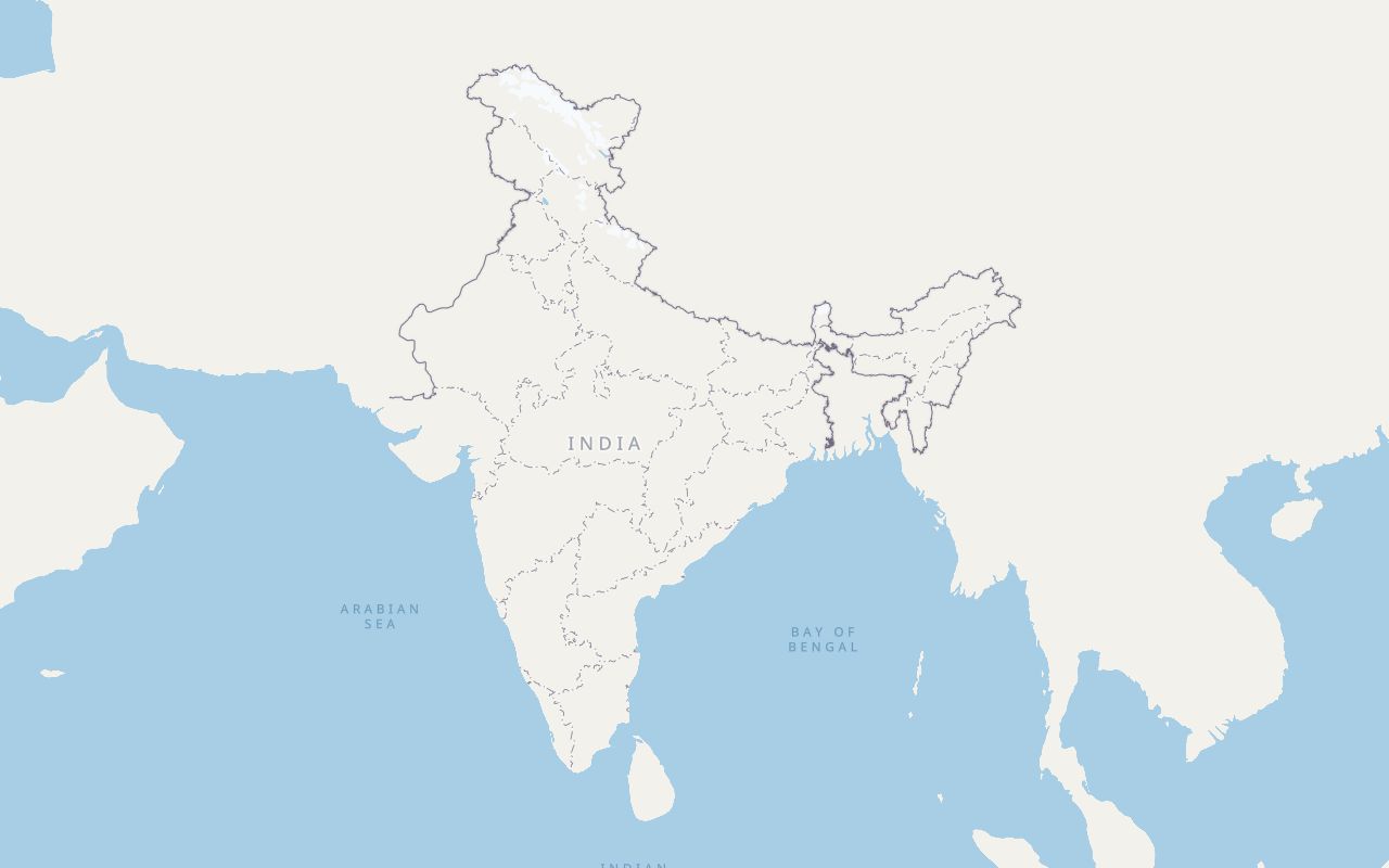
India's outer boundary, per the Survey of India
The map draws India's outer boundary the way the Survey of India does.
Street-level detail
Roads, buildings, neighbourhoods, parks, water and points of interest from OpenStreetMap, readable from the whole country down to individual streets.
Lane markings and crossings
At the closest zooms: lane dividers, one-way and turn arrows, and pedestrian crossings, drawn from OpenStreetMap tags. Where OpenStreetMap has no lane count we draw two lanes, fainter, as a guess.
Three styles
Default, Light and Dark: switchable on the live map and loadable by URL in your own app.
Made for MapLibre
Standard vector tiles and style JSON served from one host. If your app already uses MapLibre GL JS, you change a URL.
Reviewed, signed releases
A person reviews and signs each release before it goes live. The signed list of file checksums is public at maps.quantaroute.com/.well-known/quantaroute-maps/manifest.json.
Three styles, one set of tiles
The same view of Bengaluru in each style. These are screenshots of the live map, not mock-ups.
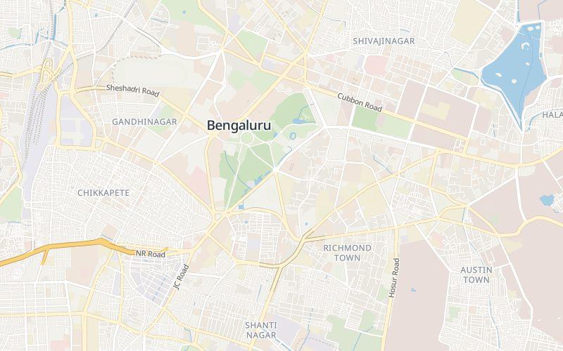
Default
maps.quantaroute.com/styles/quantaroute.json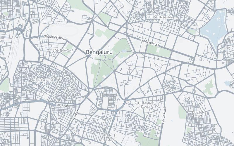
Light
maps.quantaroute.com/styles/quantaroute-light.json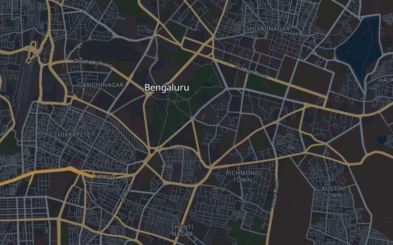
Dark
maps.quantaroute.com/styles/quantaroute-dark.jsonUse it in your app
Load the style in MapLibre GL JS. Everything the map needs (tiles, fonts, icons, boundary) comes from maps.quantaroute.com.
<link rel="stylesheet" href="https://unpkg.com/maplibre-gl@4.7.1/dist/maplibre-gl.css">
<script src="https://unpkg.com/maplibre-gl@4.7.1/dist/maplibre-gl.js"></script>
<div id="map" style="height:420px"></div>
<script>
  new maplibregl.Map({
    container: 'map',
    style: 'https://maps.quantaroute.com/styles/quantaroute.json',
    center: [76.43708, 22.66831], zoom: 3.7,   // the opening view
    minZoom: 3.2,                              // tiles cover South Asia; this is the widest view
    maxBounds: [[40, -8], [120, 52]],
    maxZoom: 21.9,
  });
</script>
Zoom 3.7 shows all of India on a screen about 570 px wide or more. In a narrower container, open lower (down to the 3.2 minimum) so India still fits.
Please do
- Keep the attribution visible. OpenStreetMap data is licensed under the ODbL, which requires it.
- Keep a fallback (a static image or the address as text) so a map problem never blocks your page.
- Pin and self-host the MapLibre files for production instead of loading them from a CDN.
Before you go to production
- There are no API keys, quotas or uptime commitments yet; traffic is rate-limited per IP address.
- If you plan real traffic, write to hello@quantaroute.com first so we can plan capacity with you.
- The default style URL can change over time. If you need an exact look, keep your own copy of the style file.
Where the data comes from
Two kinds of data are on this map, and we keep them apart on purpose.
| On the map | Comes from |
|---|---|
| India's outer boundary line | The official outline from the Survey of India, India's national mapping agency, as published through Datameet |
| Roads, buildings, places, parks, rivers, lakes, coastlines, points of interest | OpenStreetMap contributors, under the ODbL licence |
| Some low-zoom country and water features | Natural Earth (public domain) |
Only India's outer boundary follows the Survey of India. Everything else is OpenStreetMap: community-made data, not government data. This is a basemap for apps. It is not a legal or survey document.
Built on the work of OpenStreetMap contributors
Almost everything you see on this map (the roads, the buildings, the neighbourhood and place names, the parks, rivers and coastlines) was mapped by OpenStreetMap contributors: volunteers who walk, survey, trace and correct the map, then give it away for anyone to use.
We build on their work, and we want that to be plain, not buried in a footer. Thank you.
Spot a missing road or a wrong name? Fix it on OpenStreetMap. The correction helps everyone who uses OpenStreetMap, and it reaches this map the next time we rebuild from fresh data.
Credits
- OpenStreetMap contributors: map data, ODbL licence
- Geofabrik: the India extract we build from
- OpenMapTiles: the tile schema
- Planetiler: the tile builder
- MapLibre: the renderer
- Protomaps: the PMTiles format and server
- Natural Earth: some low-zoom country and water features
- Datameet: the published Survey of India outline file
Using these sources does not mean any of them endorse QuantaRoute.
What to know before you rely on it
- Coverage varies. OpenStreetMap is richly mapped in some parts of India and sparse in others, and this map shows exactly that.
- Lane markings are partly inferred. They follow OpenStreetMap lane tags; where there are none, the two lanes we draw are a guess, not a survey.
- It is a map, not live data. It is rebuilt from OpenStreetMap periodically. There is no traffic, routing or turn-by-turn on the map.
- The area is South Asia. Tiles are built only for the supported extent, centred on India.
- Search on the live map is a demo. It runs on the QuantaRoute geocoding API and each visitor has a small allowance.
- Not yet available: API keys, usage quotas, versioned styles, and a public uptime history.
Questions, or planning real traffic?
Write to hello@quantaroute.com. Looking for address lookup and DIGIPIN instead? See the Geocoding API docs.